A practical self-drive guide to the Panorama Route in Mpumalanga, taking in the Blyde River Canyon, God's Window and Bourke's Luck Potholes as the classic add-on to a Kruger safari.
- Region
- Mpumalanga, north-eastern South Africa
- Drive from Johannesburg
- Around 4-4.5 hours (380km)
- Suggested time
- 1-2 days self-drive
- Bases
- Graskop, Sabie or Hazyview
- Vehicle
- Any car; roads are tarred
- Best time
- Year-round; early mornings for clear views
The Panorama Route is one of South Africa's great scenic drives, threading along the edge of the Drakensberg escarpment in Mpumalanga, in the north-east of the country. Here the high, grassy plateau of the highveld breaks away and tumbles thousands of feet to the hot, bush-covered lowveld below, where the Kruger National Park begins. The result is a string of dizzying viewpoints, deep gorges and waterfalls packed into a compact area.
Because the escarpment sits directly above Kruger's western gates, the route has become the classic add-on to a safari: one or two days of cool mountain air, big views and easy self-driving either side of the game-viewing. The headline sights are the Blyde River Canyon, God's Window and Bourke's Luck Potholes, but the pleasure is as much in the drive itself.
This guide sets out a practical 1-2 day itinerary, where to base yourself, and how it all links to a Kruger trip.
Getting there and planning the loop
Most visitors reach the Panorama Route by road from Johannesburg or OR Tambo airport, a drive of roughly 4 to 4.5 hours via the N4 toll road towards Nelspruit (Mbombela), then up the escarpment on the R539 or R37. If you are flying, the small airport at Nelspruit (KMIA) puts you within about an hour of the southern end of the route. Many travellers tack the route onto a Kruger trip, doing it on the way in or out.
The sights run roughly north to south along the escarpment between Graskop and the Blyde River Canyon, so the natural approach is a loop. A common circuit runs north from Graskop up the R532 to Bourke's Luck Potholes and the canyon viewpoints, then doubles back, with God's Window, the waterfalls and Pilgrim's Rest slotted in along the way.
Allow far more time than the map suggests. The distances are short, but you will stop constantly for photographs, short walks and viewpoint entry queues. A focused single day covers the highlights; two days lets you slow down and add the waterfalls and Pilgrim's Rest without rushing.
Choosing a base: Graskop, Sabie or Hazyview
Where you sleep shapes how easily the loop flows. Three towns make sensible bases, each with a slightly different character and a different balance between the escarpment and the Kruger gates.
Graskop is the most central for the viewpoints and is home to the Graskop Gorge Lift, a glass lift that descends 51 metres into an indigenous forest gorge with a network of walkways at the bottom. Sabie sits in pine plantations a little to the south and is well placed for the waterfalls and the Long Tom Pass. Hazyview lies lower and warmer, closest to Kruger's western gates, and is the obvious choice if you are pairing the route tightly with a safari.
- Graskop - most central for viewpoints; Graskop Gorge Lift and several eateries
- Sabie - handy for the waterfalls, Long Tom Pass and Sudwala Caves
- Hazyview - lowest and warmest, closest to the Phabeni and Numbi Kruger gates
Day one: God's Window, Pinnacle and the waterfalls
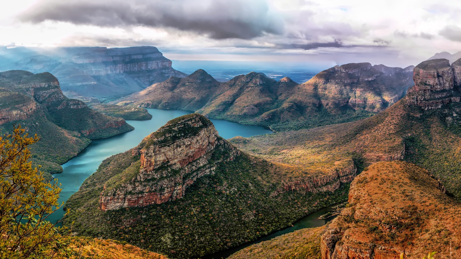
Photo by Matthias Mullie on Unsplash
Start early. God's Window is the route's most famous viewpoint, a gap in the escarpment with a sheer drop and views stretching east across the lowveld towards Kruger and the mountains of Mozambique. Mist and cloud build up over the lowveld as the day warms, so an early arrival gives you the best chance of a clear panorama; by mid-morning the view can vanish into white. A short, steep path climbs to a small patch of misty rainforest above the main lookout.
Just south, Wonder View offers an even higher vantage point, and the Pinnacle Rock, a freestanding quartzite column rising from a fern-filled ravine, is a quick and worthwhile stop. From here the road towards Sabie strings together a series of waterfalls.
You will not have time for all of them, so pick two or three. The falls are easy to reach, with short walks from car parks and small entry fees at the more developed sites.
- Lisbon Falls - the highest in the area, a wide double cascade
- Berlin Falls - a tall single drop into a green pool
- Mac Mac Falls - twin falls in a deep ravine, with the Mac Mac Pools nearby for a picnic
- Lone Creek Falls - a pretty, accessible fall near Sabie with a wheelchair-friendly path
Bourke's Luck Potholes and the rivers
Photo by Grant Durr on Unsplash
Bourke's Luck Potholes sit at the point where the Treur River meets the Blyde, and they are one of the route's most photographed spots. Centuries of swirling water and grit have drilled deep, smooth cylindrical holes and channels into the pale rock, creating a sculpted, almost lunar landscape spanned by footbridges.
There is a visitor centre with a small entry fee, toilets and a kiosk, and a network of paths and bridges lets you look down into the potholes from several angles. Take care on the rock near the edges, which can be slick, and keep an eye on children. The name comes from a prospector, Tom Bourke, who staked a gold claim nearby during the 1870s gold rush.
The potholes make a natural mid-point on the loop, roughly between the canyon viewpoints to the north and Graskop to the south.
The Blyde River Canyon and Three Rondavels
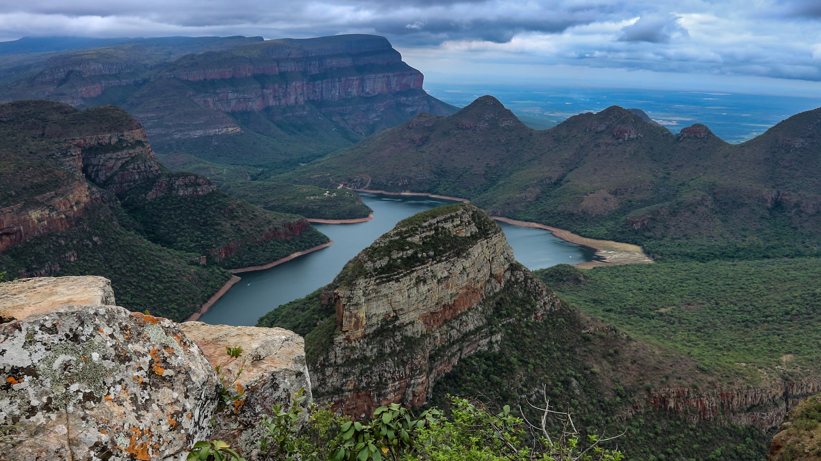
The Blyde River Canyon is the climax of the route and one of the largest canyons in the world, and unusually a green one: its walls are cloaked in subtropical vegetation rather than bare desert rock. Carved by the Blyde River, it runs for some 25 kilometres and plunges around 800 metres at its deepest, ending at the Blyde Dam.
The signature viewpoint is the Three Rondavels, three round, grass-topped peaks that resemble traditional thatched huts rising from the canyon wall, with the dam glinting far below. It is a short walk from the car park to the lookout, and there is a small entry fee. Nearby, the Lowveld View and the Pinnacle of the canyon offer further angles.
Continuing north, the road eventually reaches the Three Rondavels viewpoint as its high point before you turn back south to complete the loop. On a clear day this is among the finest views in southern Africa.
Pilgrim's Rest, Graskop and gold-rush history
Pilgrim's Rest is a preserved gold-rush town tucked in a valley off the R533, its tin-roofed cottages and old shopfronts kept much as they were when prospectors flooded in after gold was found here in 1873. Declared a national monument, it makes an atmospheric stop for lunch, a coffee or a wander among the small museums, and you can still try your hand at gold panning in the stream.
Back on the escarpment, Graskop is the route's practical hub. Beyond the Gorge Lift, the town is known for its pancakes, and its edge-of-town viewpoints look straight down into the gorge. It is a comfortable place to eat and refuel between drives.
If you have an extra half-day, the wider escarpment rewards exploration. The Long Tom Pass between Sabie and Lydenburg (Mashishing) is a scenic high-altitude drive named after a Boer War gun, and the Sudwala Caves, a dolomite cave system near Sabie, make a good rainy-day or hot-afternoon alternative.
Linking to Kruger and when to go
The Panorama Route sits directly above Kruger's western flank, which is what makes it such a neat pairing. From Hazyview, the Phabeni Gate is around 12 kilometres away and the Numbi Gate a little further; both lead into the park's southern section, the most wildlife-rich and accessible part of Kruger. A typical trip does the route over one or two days, then drops down to a gate to begin the safari.
The route works year-round, but timing matters. The dry winter months from May to September bring clear, cool mornings ideal for the viewpoints, and they coincide with Kruger's peak game-viewing season, when thinner vegetation and sparse water draw animals into the open. Summer is greener and more dramatic, with afternoon thunderstorms and a higher chance of cloud swallowing God's Window.
Whatever the season, mornings are best on the escarpment: get to the eastern-facing viewpoints early before the lowveld haze and cloud build.
Practical tips for the drive
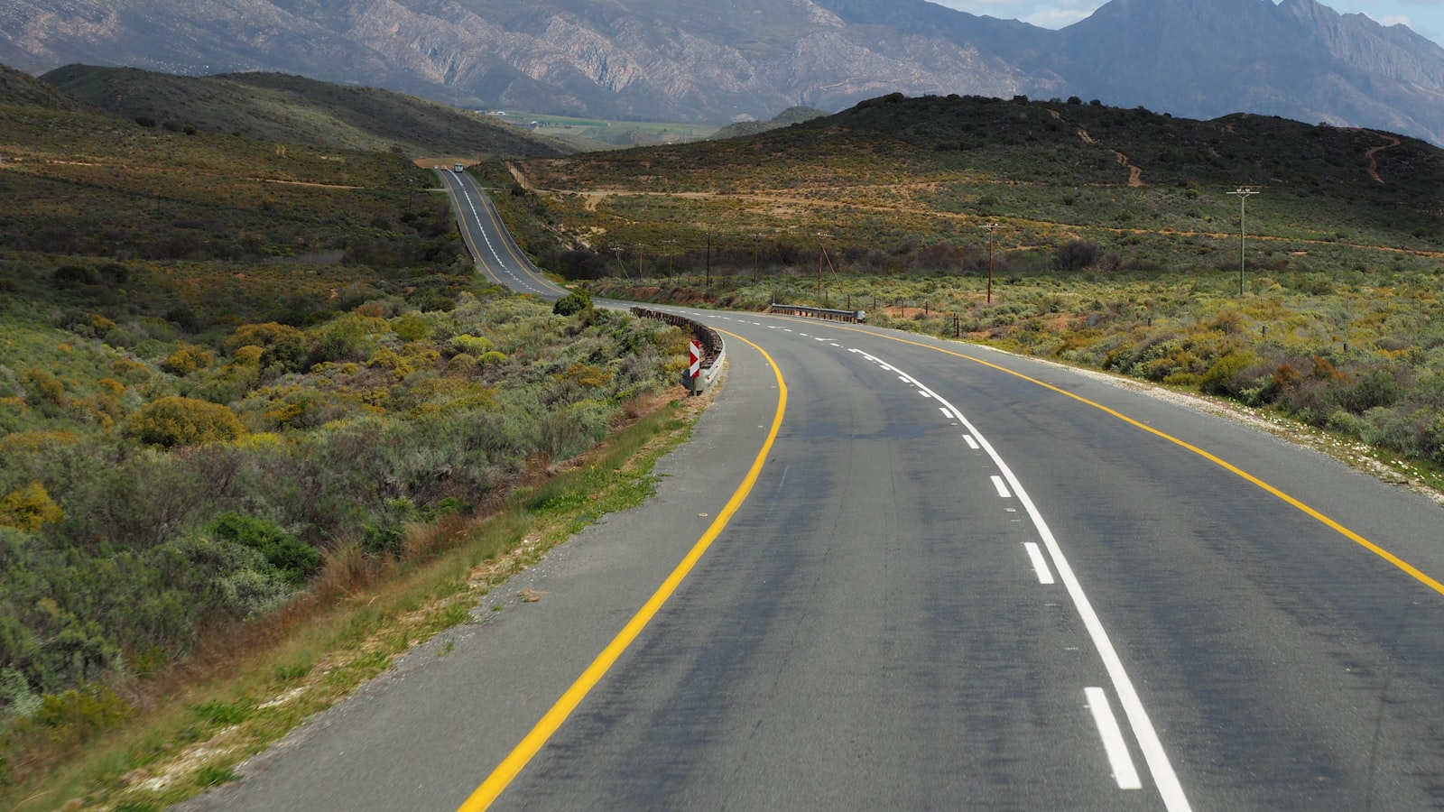
The Panorama Route is genuinely easy to self-drive. The roads are tarred and a normal hire car is fine; you do not need a 4x4. Fill up with fuel in Graskop, Sabie or Hazyview, as petrol stations thin out along the loop, and carry drinking water and snacks.
Several viewpoints charge a small entry fee, often payable in cash, so keep coins and small notes handy. As at any busy tourist spot, be alert at the larger car parks: do not leave valuables visible in the car, and keep bags close at crowded lookouts. Wear shoes with grip for the short trails, which can be wet and uneven.
- Carry small change in cash for viewpoint entry fees
- Refuel in the main towns; allow extra time for stops and photos
- Go early to beat cloud at God's Window and the canyon
- Do not leave valuables in the car at busy viewpoints
- Wear sturdy shoes for slippery rock and short trails
Frequently Asked Questions
- How long do you need for the Panorama Route?
- One full day covers the main highlights, namely God's Window, Bourke's Luck Potholes and the Blyde River Canyon. Two days is more relaxed and lets you add the waterfalls, Pilgrim's Rest and Graskop Gorge Lift without rushing. Allow far more time than the short distances suggest, as you will stop constantly for photographs and viewpoints.
- Can you drive the Panorama Route in a normal car?
- Yes. The route follows tarred public roads and an ordinary hire car is perfectly fine; you do not need a 4x4. The driving is straightforward, though there are some winding mountain passes. Just refuel in the main towns of Graskop, Sabie or Hazyview, as petrol stations are limited along the loop itself.
- What is the best time of day to visit God's Window?
- Early morning. God's Window faces east over the lowveld, and as the day warms, mist and cloud build up from below, often hiding the view entirely by mid-morning. Arriving soon after opening gives you the best chance of the sweeping panorama towards Kruger and Mozambique before the haze rolls in.
- How does the Panorama Route connect to Kruger?
- The route runs along the escarpment directly above Kruger's western gates. From Hazyview, the Phabeni Gate is about 12 kilometres away and Numbi Gate slightly further, both leading into the park's wildlife-rich southern section. This makes the route the classic one or two day add-on before or after a Kruger safari.
- What are the must-see stops on the Panorama Route?
- The big three are the Blyde River Canyon with its Three Rondavels viewpoint, God's Window, and Bourke's Luck Potholes. Add the Pinnacle Rock, Wonder View, a couple of waterfalls such as Lisbon and Berlin Falls, the historic town of Pilgrim's Rest, and the Graskop Gorge Lift if time allows.
- Do the viewpoints charge entry fees?
- Several do, including God's Window, Bourke's Luck Potholes and the Three Rondavels. The fees are small but are often best paid in cash, so carry coins and small notes. The Graskop Gorge Lift and Sudwala Caves charge separate, larger admission fees for their full experiences.
- When is the best season to drive the route?
- It is rewarding year-round. The dry winter months from May to September bring clear, cool mornings and coincide with peak Kruger game-viewing. Summer is lush and green but brings afternoon thunderstorms and a greater chance of cloud obscuring the viewpoints, so plan early starts whatever the season.